
We are now in the main phase of this winter storm and it will be a high impact event with heavy snowfall, very strong northwest wind gusts and hazardous travel through tonight and early Monday. The western boundary of the Winter Weather Advisory and Blizzard Warning is already in effect this morning, with conditions continuing to deteriorate as the storm moves eastward. In the Mankato/North Mankato area, the Blizzard Warning goes into effect at 9 a.m. Sunday and continues through 9 a.m. Monday. The western boundary of the Blizzard Warning and Winter Weather Advisory went into effect at 6 a.m. Sunday.
TIMING: Snow is already moving across South Dakota and western Minnesota early this morning and will continue to spread eastward across Minnesota throughout the morning and early afternoon. The worst conditions will extend from west to east until mid-morning and late morning. The Twin Cities and eastern Minnesota will see snow and wind increase late morning through early afternoon. Snow will gradually cease from west to east early Monday morning, but blowing snow will likely persist.
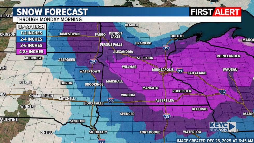
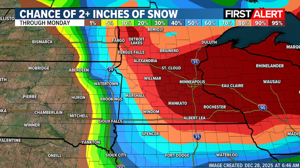
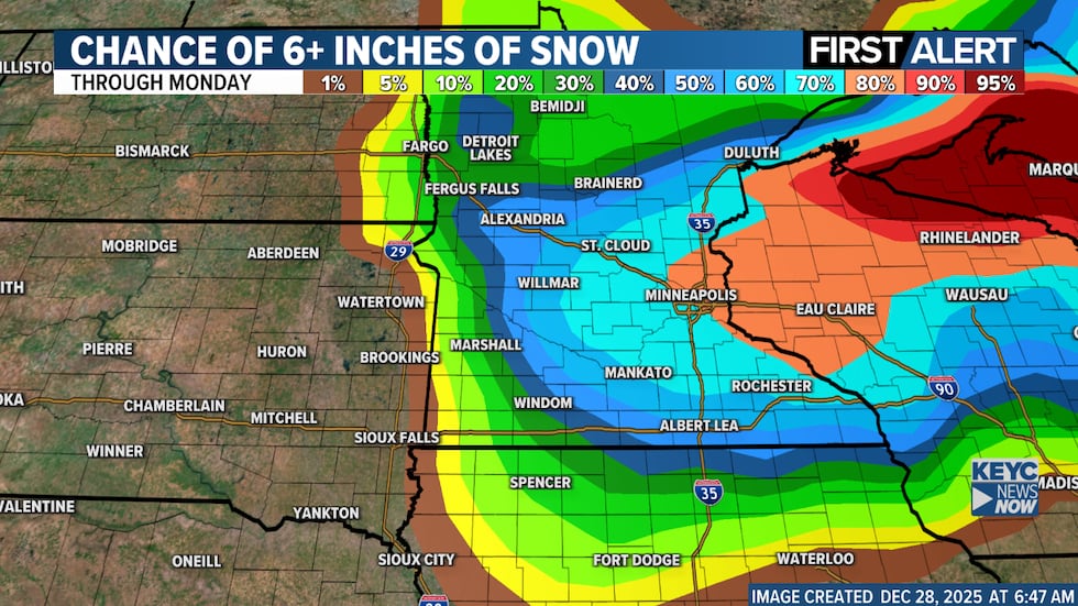
SNOW AND IMPACTS: The heaviest snow remains concentrated from the central and south-central areas into eastern Minnesota and western Wisconsin, where 5 to 10 inches are likely, with locally higher amounts possible. Snow amounts decrease further west, but even areas with lower totals may experience blizzard-like conditions due to the very strong wind gusts expected. Blizzard warnings are in effect across much of western, central and southern Minnesota, while winter storm warnings are in effect across east-central Minnesota and western Wisconsin. I’m also sharing updated snow forecast graphics showing the likelihood of 2+ inches and 6+ inches of snow, along with the latest warnings and advisories in effect through Monday morning.
WIND: Wind is a major impact factor today. Northwest wind gusts are rapidly intensifying and could reach 45 to 55 mph in parts of Minnesota, especially in Blizzard Warning areas. Widespread blowing and blowing snow will make travel extremely dangerous, even after snowfall eases this evening.
Travel is strongly discouraged today and this evening. Conditions can sometimes become difficult or even impossible, especially in open areas. Stay tuned! I will be monitoring everything closely and we will have updates throughout the day.
Click here to download the KEYC News Now app or our KEYC First Alert weather app.
Copyright 2025 KEYC. All rights reserved.


